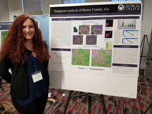
The science of Geographic Information is a rapidly developing academic field which supports a tremendous variety of geographic fields. An essential tool in the discipline is a Geographic Information System (GIS), which uses computer hardware and software to allow users to develop, analyze, and display spatial data. A GIS is more than a map-making tool; it is a spatial database that permits very advanced spatial analysis and modeling. Often it is used in conjunction with remote sensing software, which is used to display and analyze photographic and satellite imagery.
The foundations of Geographic Information Science (GISc) at Georgia College & State University are presented in a two-course series:
Resources and Research
The faculty and staff at GC have been working hard to develop state-of-the-art instruction and research facilities for GISc. Student instruction is carried out in a campus-wide Office of Instructional Technology classroom, which is fitted with 24 IMacs running VMware to support a Windows 10 operating system. This installation supports the following GISc software:
The foundations of Geographic Information Science (GISc) at Georgia College & State University are presented in a two-course series:
- GEOG 3100: Introduction to Geographic Information
- GEOG 4100: Advanced Geographic Information
Resources and Research
The faculty and staff at GC have been working hard to develop state-of-the-art instruction and research facilities for GISc. Student instruction is carried out in a campus-wide Office of Instructional Technology classroom, which is fitted with 24 IMacs running VMware to support a Windows 10 operating system. This installation supports the following GISc software:
Georgia College is supported by the University System of Georgia's site licensing arrangements for GISc software. The ESRI site license is managed by the Information Technology Outreach Services at the University of Georgia, and the Leica site license is maintained by the College of Architecture at Georgia Institute of Technology.
Students and faculty also have access to a growing collection of advanced geographic hardware and instrumentation, including:
- Geoscope mirror stereoscopes
- Sokkia MS-27 Professional Mirror stereoscope
- CST/berger 20X Speed Line Level & Transit-Level
- Sokkia Set-600 Total Station
- Garmin GPS Map 76Cx receivers
- Garmin Etrek GPS receivers
- Trimble GeoXM receiver and data logger
- Calcomp Drawing Board III
- Epson GT-15000 large format scanner
- HP DesignJet 1055cm Plus plotter
- HP Photosmart Pro B9180 large format printer
GISc courses at GC utilize an instructional method known as Problem-Based Learning, which encourages students to pose problems and then solve them using methods delivered in class lectures and activities. The instructor works with the students to build knowledge and craft solutions, but the overall direction and conclusions of the project belongs to the student. A collection of some of the student projects demonstrates the method, and several of these projects directly serve the local community. In fact, the GC Geographic Research Lab has served over 20 different local entities and agencies in their needs. The local research projects outline the important contributions of GC to the surrounding region.
Geographic Information Science Web Links
Geographic Information Science is a rapidly growing field which offers incredible opportunities. To learn more, please visit the essential web links below:
Geographic Information Science is a rapidly growing field which offers incredible opportunities. To learn more, please visit the essential web links below:

